

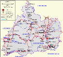
Tourism in the province of Cotopaxi
Tourism in Cotopaxi
Tourism in Cotopaxi
OTROS SITIOS INTERESANTES
La Laguna del Quilotoa
- The Quilotoa Lagoon was formed in the crater of the Quilotoa volcano. Quilotoa is a caldera filled with water from the westernmost volcano in the Ecuadorian Andes. The 3 kilometer wide caldera was formed by the collapse of this dacite volcano after an eruption about 800 years ago.
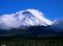
- The Cotopaxi National Park has many attractions such as: Laguanas, forests, trails, glaciers, etc.
- The Los Illinzas Ecological Reserve is located in the province of Cotopaxi near Sigchos.
- City of flowers and fruits, also known as the "Three Juanes" city, and the capital of the Tungurahua province. Typical meals are the "llapingachos", the guinea pigs (cuyes) and in November the famous "Colada Morada" (sweet warm drink).
- You can also enter the park with the train from Quito and Ambato.
MUNICIPIOS / CANTONES
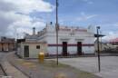
- Latacunga is the capital of the Cotopaxi province. Latacunga is famous for its Hallullas and cheeses in leafs (quesos de hoja). One of the typical foods are chugchucaras.
La Maná
- La Maná is on the Latacunga - Quevedo road, and has a warm climate.
Pangua
- The cantonization parties of Pangua are the first of June.
Pujilí
- Pujilí is 12 km from Latacunga, and has a famous fair. Here we work the different crafts.
Salcedo
- Salcedo is 15 km south of Latacunga, has a beautiful center, and is famous for its ice cream flavors.
Saquisilí
- Saquisilí is 11 km away in the north of Latacunga, and has a famous fair. Here we work the different ceramic and textile handicrafts.
Sigchos
- Sigchos is 40 km north of Latacunga near the Iliniza volcano. From Sigchos you can also reach the Los Illinizas Ecological Reserve.
The Province of Cotopaxi has 500,000 inhabitants, 290,000 urban inhabitants and 210,000 rural inhabitants.
The province of Cotopaxi covers an area of 6,048 square kilometers, divided into 7 cantons.
Saquisilí and Pujilí are places where different handicrafts are made in the province.
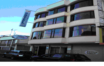
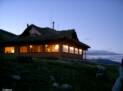
in Latacunga we recommend:
Ritzor Hotel
All our rooms have private toilets and hot water showers, tv cable, garage. Best quality with low price level.
Restaurant Cafeteria - Special Suits - Terrace - Wifi - Conference room
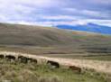
Cotopaxi produces food such as corn, barley, potatoes, broccoli, wheat and flowers, there are large areas for cattle. In warmer or subtropical areas, cocoa, bananas, coffee and sugar cane are grown.

CC

(593) 03- 280 99 71


Otras provincias, ciudades y sitios
Imbabura - Loja - Los Rios - Manabi - Morona Santiago - Napo - Orellana - Pastaza - Pichincha - Santa Elena