
Tourism in Chimborazo
Tourism in Chimborazo
CC
The Province of Chimborazo has 430,000 inhabitants, 170,000 urban inhabitants and 260,000 rural inhabitants.
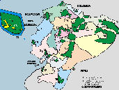
The province of Chimborazo has an area of 6,495 square kilometers, divided into 10 cantons.
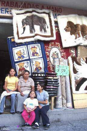
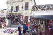
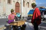
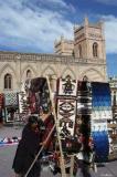
Guamote and Guano are places where different crafts are made in the province.
Guano carpets, near Riobamba
The Chimborzo province has the Chanchán river, to the south of the province, which receives the waters of the Chunchi, Guasuntos, Sibambe and Zula rivers, and flows into the Chimbo river. On the other hand, the Chambo River, which runs through the province from south to north, is fed by the Blanco, Chibunga, Guamote, Pulucate, San Juan and Sicalpa rivers, and joins the Patate to form the Pastaza.
The hydrography of the province is complemented by two important lake complexes: Ozogoche, formed by several lagoons that give rise to the Chambo River, and Atillo in the Guamote canton. Another important lagoon is that of Colta, which is characterized by abundant reed vegetation.
The Province of Chimborazo has the cantons: Alausí, Colta, Cumandá, Chambo, Chunchi, Guamote, Guano, Pallatanga, Penipe and Riobamba.
Tourism in the
Chimborazo Province


Other cities and sites
Other provinces
Imbabura - Loja - Los Rios - Manabi - Morona Santiago - Napo - Orellana - Pastaza - Pichincha - Santa Elena
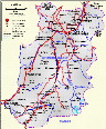
MUNICIPALITIES / CANTONS
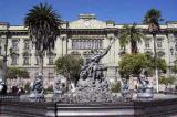
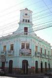
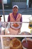
- It is the capital of the province of Chimborazo, with different fairs and beautiful houses and buildings. From Riobamba you can make different excursions: visit the Sangay National Park, buy carpets in Guano or visit the lagoons that are in the province.
- Alausí is in the south of the province. Among others, it is famous for its railway station, where you leave for the Nariz del Diablo: an impressive journey on the train.
Colta
- Colta is famous for its fairs and its typical foods. The Colta lagoon is also very famous.
Chunchi
Guamote
- Guamote is known for its fairs and crafts.
Guano
- Guano is located at a distance of 6 km from Riobamba, and is famous for its woolen rugs and handicrafts.
Penipe
- Penipe is on the slopes of the Tungurahua volcano and is a quiet town.
Pallatanga
- Pallatanga has a subtropical climate and is located on the Riobamba - Guayaquil road.
Chambo
Cumandá
Laguna Ozogoche
Laguna de Colta
Nevado El Altar
Aguas termales de Cunug Pugyo y Guallabamba
Nariz del diablo
Cementerio Paleontológico de Punín
Catedral de Riobamba
Museo del Convento de La Concepción en Riobamba
Museo del Banco Central en Riobamba
Museo Casa de la Cultura Ecuatoriana en Riobamba
Iglesia de Balbanera
Encuentro del Nuevo Mundo del Folkclor, marzo o abril
Complejo parque acuático Los Elenes
Travesía en ferrocarril

OTROS SITIOS INTERESANTES
- The Chimborazo Faunistic Production Reserve has an area of 58,560 hectares. The highest volcano in the world (measured from the center of the earth), Chimborazo at 6,310 meters, is part of the reserve.
- The active volcanoes Tungurahua and Sangay 5,230 masl are within the Sangay National Park. There are different agencies and professional guides that offer their professional mountaineering services.
The population is dedicated mainly to agriculture; Due to the diversity of climates, in this province there is a great variety of products such as: cereals and legumes, the main products being corn, barley, potato, wheat, spring peas, lentils, red onion, garlic, tender bean, quinoa, lupine and melloco, with a cold and temperate climate. In the subtropics it produces: coffee, cocoa, cassava, bananas, sugar cane and fruits, mainly citrus.
Other activities of the province's economy are: livestock, deposits of silver, copper, gold, marble, iron, limestone and sulfur, handicrafts, beekeeping, tile and brick manufacturing.
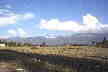
The various ecological floors that the province has range from the páramos to the subtropical zone, in Cumandá they give rise to climates that range from the temperate of the valleys to the icy high mountains, passing through the cold of levels that reach 3,000 meters high. The average temperature is 13°C.
Fuentes: chimborazo.gob.ec; wikipedia
